Swalim News and Events
FAO-SWALIM Work in Puntland
Since 2006 Somalia Water and Land Information Management (SWALIM) has been operating in Puntland. Informative data has been collected on land, water and climate. The information is organized in themes: Water resources (Climate, floods, water resources and water reports); Land resources (Land degradation, Land suitability, soils and land reports). This information is generated with the support of a strong Information management, GIS and remote sensing units in collaboration with Puntland government partner institutions. SWALIM information management team has organized the data to facilitate quick retrieval through a variety of online and offline platforms. Download publication (pdf, 3.5 MB)
The Puntland water and land resources – Information Management Center
The Information Management Center (IMC) will be a special agency under the Puntland State of Somalia whose main function shall be to collect, process and analyze water and land resources information in coordination with the relevant government institutions, in support of policy development for sustainable and integrated water and land resources management, and to provide water and land related data and information to the end users. Download pdf(2.5 MB)
FAO-SWALIM Recognised for Partnership with Banadir University
FAO SWALIM has been working together with academic institutions in order to foster long-term research relationships on specific projects of interest and to generate knowledge for the betterment of the lives of Somali communities.
Journal Publications
Validation of the CHIRPS satellite rainfall estimates over eastern AfricaIn focus
Sustained “no regrets” humanitarian efforts urgently needed in response to drought in the Horn of Africa
Catastrophic consequences of the multi-year drought will continue in 2023, leaving communities in urgent need of assistance. Seasonal forecasts suggest a reasonable chance that the upcoming March–May rains will again underperform which, should it occur, would be an unprecedented sixth poor season. Communities will need years to recover from this historically severe drought.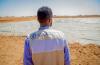
Climate-smart water harvesting and storage systems help rural communities overcome climate shocks
FAO and the European Union partner with government and communities to strengthen water resource management for improved food security in Puntland and Somaliland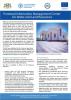
EU and FAO handover a new Water and Land Information Management Centre to Government of Somalia in Puntland
This Centre will support the Government in management of land and water resources, and ultimately the people of Somalia as we are all the stewards of these assets for now and for the future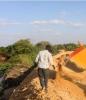
Improving flood response in Somalia through remote sensing
Satellite imagery reports riverbank breakages in real timeSomalia, like many countries, is affected by frequent climate-related hazards such as floods, droughts and tropical storms.SWALIM Publications
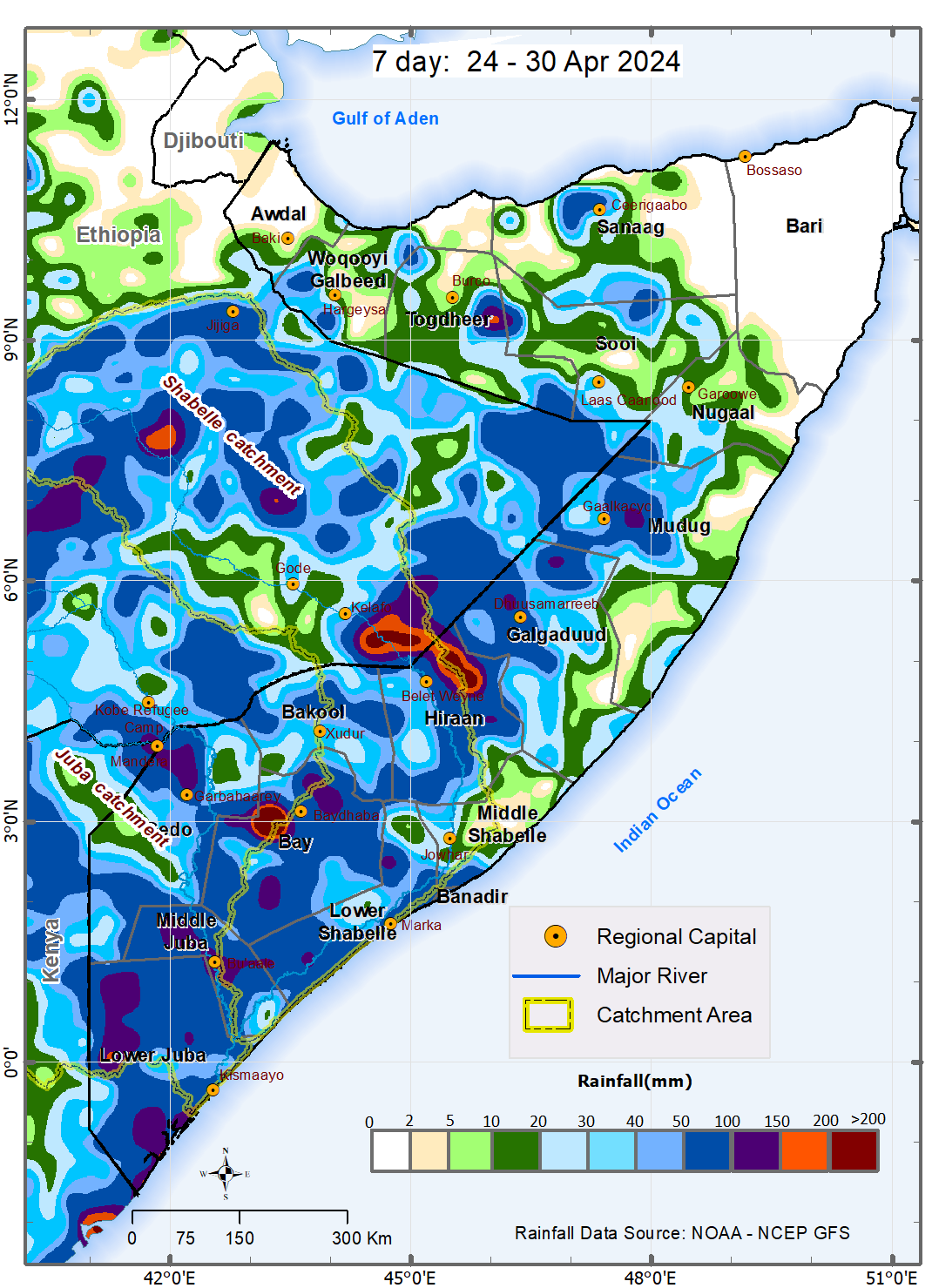
Somalia Rainfall Forecast – Issued 25 April 2024
During the week between 24 and 30 April 2024, and based on NOAA-NCEP GFS, Light to Moderate rains are expected over the vast majority area in Woqooyi Galbeed, Togdheer, Sool and Nugaal Regions. Most parts of Awdal, Sanaag, and Bari Regions will be dry over the forecast period.Publication Download
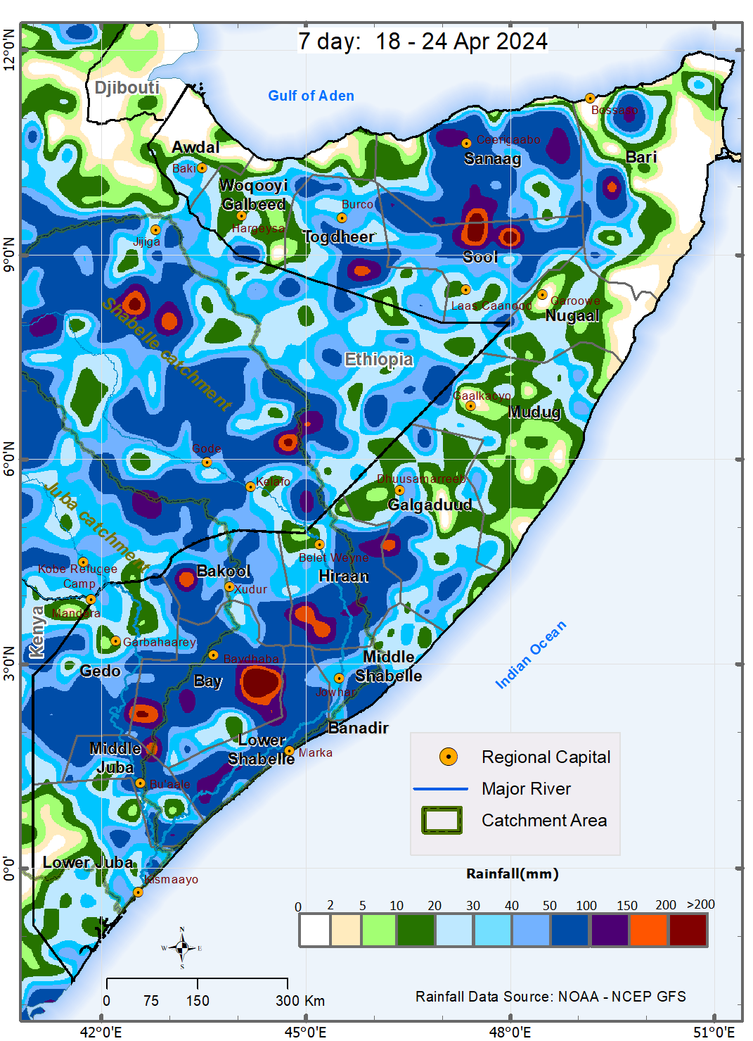
Somalia Rainfall Forecast – Issued 19 April 2024
During the week between 18 and 24 April 2024, and based on NOAA-NCEP GFS, moderate to heavy rains are expected over several areas in the South West and Hirshabelle States with chances of very heavy rains over some areas in Bay and Sool-Sanaag regions.Publication Download
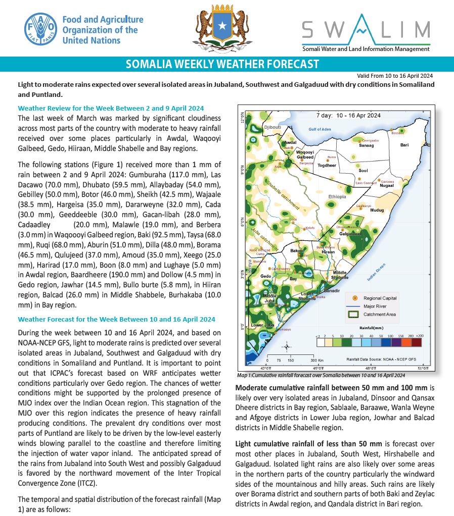
Somalia Rainfall Forecast – Issued 10 April 2024
During the week between 10 and 16 April 2024, and based on NOAA-NCEP GFS, light to moderate rains is predicted over several isolated areas in Jubaland, Southwest and Galgaduud with dry conditions in Somaliland and Puntland.Publication Download
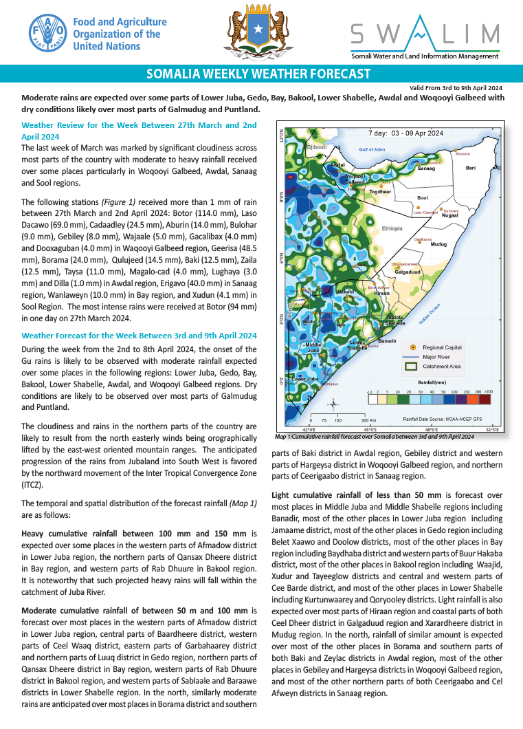
Somalia Rainfall Forecast – Issued 04 April 2024
During the week from the 2nd to 8th April 2024, the onset of the Gu rains is likely to be observed with moderate rainfall expected over some places in the following regions: Lower Juba, Gedo, Bay, Bakool, Lower Shabelle, Awdal, and Woqooyi Galbeed regions.Publication Download
Donors
SWALIM is a multi-donor project managed by FAO and currently funded by The European Union, USAID, SDC, FCDO and Government of France
![]()
![]()
![]()
![]()
