SWALIM Gives Training on Land Degradation and Land Cover Mapping in Puntland
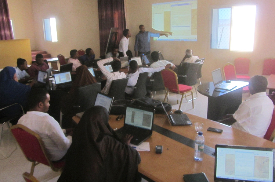
As part of its ongoing capacity-building efforts to the Somali line ministries, SWALIM carried out nine days of practical training on open-source Geographic Information Systems (GIS) tools and methods for mapping Land Degradation and Land Cover using remote sensing technologies. The hand-on courses were delivered within the Puntland Ministry of Environment, Wildlife and Tourism (MoEWT). This training and mapping exercise also supports the Millennium Development Goals (MDG) initiative, and a portion of the training was dedicated to the detection, mapping and analysis of a specific site of Land Degradation in Puntland. Transferring knowledge for the sustainable implementation of MDG program is a core SWALIM focus in this phase of the project.
SWALIM gave the training to twenty-seven staff members drawn from the MoEWT, the Ministry of Agriculture and Irrigation (MOAI), the Puntland State Agency for Water, Energy and Natural Resources (PSAWEN). Staff from UNHABITAT also participated. The hands-on training employed open-source “Quantum-GIS” software for GIS data creation, map production, land degradation assessment and land cover mapping.
Similar training programs are planned for Mogadishu, in April, and Hargeisa in May.
Nike sneakers | 【6月上旬発売予定】 ナイキ エアフットスケープ モーション 全4色 - スニーカーウォーズ